Version 3 of Mountain High’s free app for iPhone and Android is filled with enhanced tracking features and better power savings tools. It allows users to track and share on Facebook and Twitter the number of runs they have done, vertical feet conquered, maximum speed achieved, photos and videos taken, number of days on the mountain and many other metrics. At the day’s end, the app allows users to compare their achievements to those of their friends by easily accessing the data on their smart phone or any online computer.
There are also new challenges based on criteria such as vertical, distance, and number of runs. With the phone’s GPS tracking capabilities guests can pinpoint themselves on Mountain High’s trail map and then locate their friends. There are real time conditions such as snow reports, custom weather forecasts, and park updates. The new Mountain High app is now available for download at mthigh.com, the Apple APP Store, and the Android Marketing place.
Developed by Treeline and powered by their TrailTap technology, the new Mountain High App is the first resort app to offer such robust technology-bundling. The result is unsurpassed synchronization of realtime weather data, social media, rider- and resort-generated images and videos, GPS-enabled trail maps and usage tracking.
Says John McColly, CMO, “The new Mountain High App is even better than before. We’ve improved the tracking capabilities, reduced its battery consumption, and added a number of other key features. Download it for yourself today.”
While at the resort users can “check in” on Facebook, have that status posted on their page, and/or connect with their Facebook friends that are also checked in at Mountain High. These friends can be noted on a simple list or their recent locations can be plotted on the app’s user-friendly interactive trail map, identical in appearance to the traditional, James Niehues-illustrated Mountain High paper trail map. The Mountain High App is one of very few ski-area apps with an interactive map that includes the names and positions of trails, lifts, restaurants and bars and the other resort details typically found on traditional paper trail maps.
Additionally, the Mountain High App provides skiers and snowboarders with real time access to multiple live cams, the latest snow and weather conditions, and even if their favorite pros are on the mountain. The app also features a calendar of on-mountain events and deals on lift tickets, lessons, food, and equipment. Throughout the season, Mountain High will introduce new features for the app, including competitions for prizes.
For more information or to schedule an interview please contact John McColly, CMO, at (760) 316-7803 or john@mthigh.com
# # #
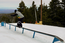
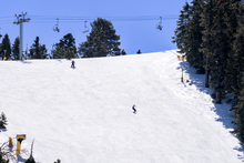
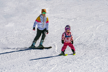
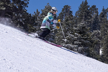
Mountain High is Southern California’s closest winter resort located just an hour and a half from Los Angeles and Orange County. The area consists of three separate mountains (Mountain High East, West, and North), and offers a wide variety of lifts and trails, a world-class terrain park, an outstanding Winter Sports School, and the region’s largest tubing area. Night skiing & snowboarding are available 7 nights a week and snowmaking covers more than 80% of the slopes. Mountain High has been the first resort to open in Southern California for the past 17 years and traditionally operates from mid November to mid April. Get more at mthigh.com.